
 ChatGPT
 Perplexity

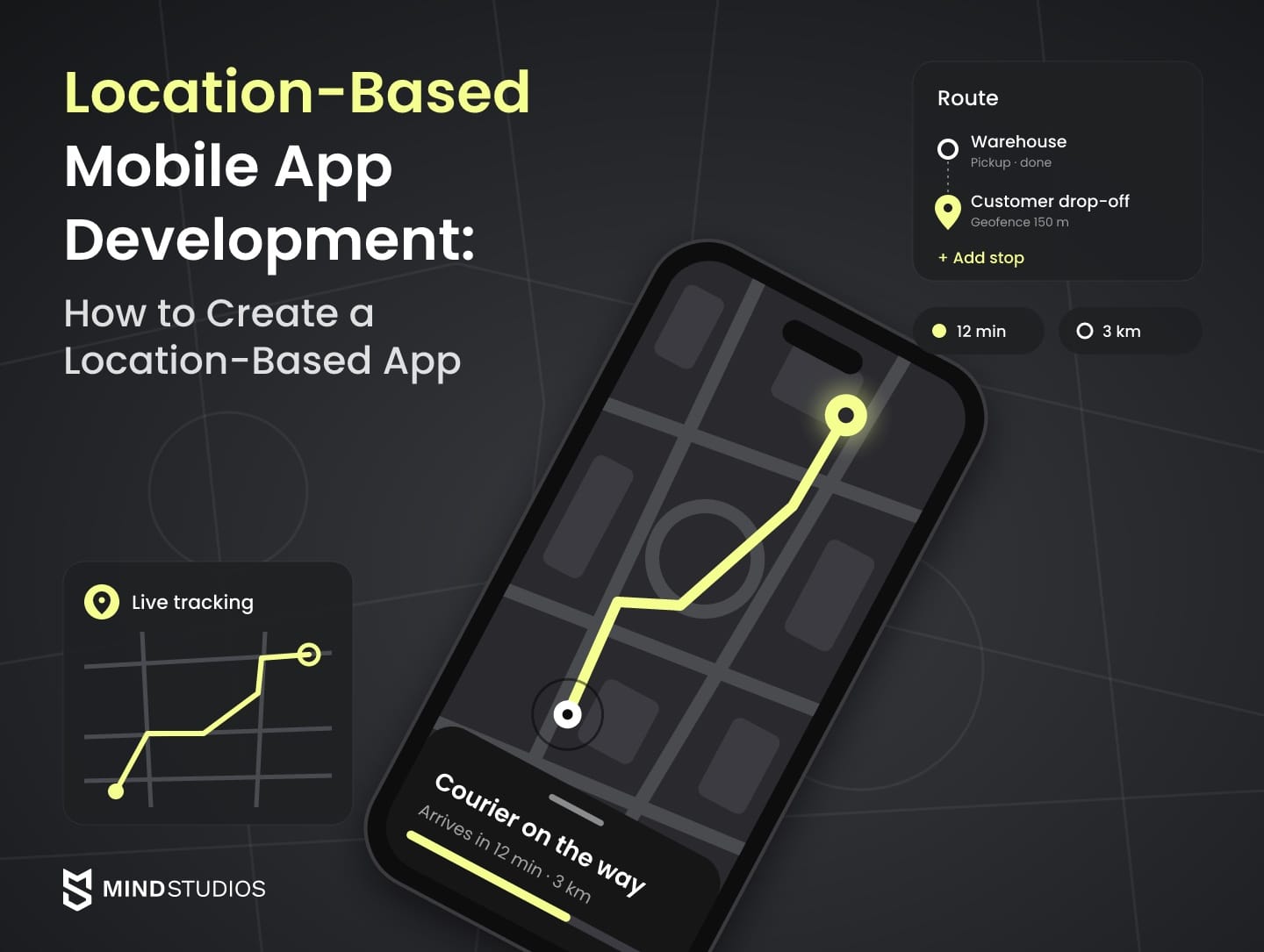
A location-based app looks like a map with pins. Behind the map, the workflow decides how often the app needs a position, what happens when it can't get one and what the map provider bills.
Highlights
- Positioning choice trades accuracy for battery, so settle it before design.
- Background location rules differ on iOS and Android, so test permissions on both.
- Map providers bill on different units, so compare them at target volume.
Most of the work in location-based mobile app development sits behind the map. The team decides how accurate a position must be, how often the app tracks in the background and which provider bills for map views and address lookups. Those choices set most of the cost and risk.
Most teams we talk to already run a product and need location inside it. We've built that logic for delivery, field logistics and venue platforms. This guide covers geolocation app development in the order we settle those decisions with clients, which is also the practical answer to how to create a location-based app.
If you're adding location to a product with paying users, the first question is which of these decisions your current stack already answers.
What location-based mobile app development involves
Location-based mobile app development turns raw position signals into events a business acts on, such as a courier's ETA or a technician's arrival on site. The work spans four layers, and the first two, the phone and its positioning APIs, cap the accuracy you can promise before any backend work starts.
The four layers of a location-based product
Each layer fails in its own way, so it helps to name them before scoping:
- Device. Satellite, Wi-Fi, cellular and Bluetooth radios plus motion sensors. The phone model and OS version limit accuracy and background behavior.
- Positioning APIs. Apple's Core Location framework gathers data from Wi-Fi, GPS, Bluetooth, cellular and other hardware. Android's Fused Location Provider combines GPS, Wi-Fi and cell signals with motion sensors.
- Geodata backend. Stores coordinates, runs spatial queries such as "open jobs within 3 km" and evaluates geofences.
- Map and notifications. Map SDK, geocoding, routing and push messages: the location-based services people actually see.
Positioning technologies compared
How the device gets its position shapes every later decision. Battery impact varies by device and settings, so treat that column as things to measure in field tests.
Technology |
Typical accuracy |
Battery impact |
|---|---|---|
GNSS (GPS and other satellite systems) |
Best under open sky |
High in high-accuracy mode |
A-GPS |
Faster time to first fix, per NENA's definition |
Measure on target devices |
Wi-Fi network location |
20–50 m where Wi-Fi is available, per Android's geofencing guide |
Lower in balanced mode |
Cell ID |
City-level in Android's low-power mode |
Minimal in that mode |
BLE beacons |
Proximity to installed beacons, relative to a nearby iBeacon in Core Location |
Measure at your scan rate |
Wi-Fi RTT |
1–2 m with three or more RTT-capable access points, per the Wi-Fi RTT docs |
Measure in your scenario |
UWB |
About 10 cm between two UWB devices, per Android's UWB guide |
Measure in your scenario |
The GPS.gov accuracy page notes that satellite accuracy worsens near buildings, bridges and trees. Android's battery guide warns that high-accuracy mode, which enables GPS, may cause significant drain, while balanced mode typically uses Wi-Fi and cell data to save power and low-power mode relies largely on cell towers.
Where each technology fits:
- GNSS: outdoor tracking, live ETA, route history.
- A-GPS: tracking that starts cold at shift start.
- Wi-Fi network location: area search, building-level geofences.
- Cell ID: region detection, fallback.
- BLE beacons: venue check-in, store zones.
- Wi-Fi RTT: indoor navigation in warehouses and malls; throttled in the background.
- UWB: asset finding, door proximity; needs UWB hardware on both ends.
Core Location and the Fused Location Provider blend the first four sources into one position. Wi-Fi RTT and UWB need separate APIs and compatible hardware, so indoor precision often means installed equipment and site calibration on top of the app itself.
Types of location-based apps businesses build
This guide groups the location-based apps businesses build by the location function each workflow depends on:
- an order radius;
- a verified trip;
- a live vehicle position;
- a map search;
- a store geofence;
- a venue check-in.
The business result of each function varies more than the map view suggests:
| Type | Core location function | Business result |
|---|---|---|
| Delivery and on-demand | Work area and order radius for shoppers, order status for buyers | Orders reach people who can deliver them fast |
| Field workforce and dispatch | Assigned routes, planned vs. actual mileage, real-time route changes | Dispatch and payroll based on verified trips |
| Logistics and fleet | Live vehicle positions, route history, stop events | Fewer status calls, auditable trips |
| Real estate and property search | Map search with radius and polygon filters | Buyers find listings in the areas they want |
| Retail and geofencing | Store geofences, pickup arrival alerts, in-store zones | Orders ready when the customer pulls in |
| Venues and events | Venue map with point clustering, QR check-in | Discovery, entry and payment in one system |
Our published cases cover three of these types:
- James Butler offers 30-minute delivery in Denmark, with four native apps built in three months.
- OÖ Medienlogistik covers fleet, dispatching and mileage verification for a print media delivery company.
- Unight is a nightlife discovery and booking platform built for China.
For logistics and fleet, see our logistics software experience and a breakdown of fleet app costs.
For property search, see our real estate projects and a guide to marketplace development.
Key features of a location-based app
A location-based app's first version includes only the features its main workflow needs. A public property search can run on a map and area filters with no sign-in, while a courier product needs tracking, history and, once arrival times are promised, an ETA. Offline maps, AR and analytics wait until a workflow depends on them.
Core features and when they're required
Each row names the condition that makes a feature mandatory, so one table serves a listing search, a courier app and a dispatch platform.
| Feature | Required when | Business purpose |
|---|---|---|
| Interactive map with clustering | Users choose places, people or assets visually | Faster decisions than a list of addresses |
| Search and filters by area | Users look for listings, stores or jobs in a radius or polygon | Results match the area the user cares about |
| Accounts and sign-in | The app keeps personal history or non-public data | Saved searches, trip history, protected records |
| Roles and access rules | Couriers, dispatchers and customers see different location data | Each person sees only what their job needs |
| Permission and fallback flows | The app requests any location permission | The app stays usable when people deny precise or background access |
| Tracking at a set interval | Someone needs positions over time, such as a route or visit log | Proof of where work happened |
| Geofences | Entering or leaving a place should trigger an event | "Arrived on site" events without manual check-ins |
| Location-triggered notifications | A location event changes what someone does next | Staff and customers act on time |
| ETA for the customer | You promise customers an arrival time | Fewer "where is my order" calls |
| Location history and audit trail | Payroll, billing or disputes rely on where someone was | Evidence for a client or auditor |
| Admin dashboard with live map | Someone assigns or monitors work in real time | Dispatchers spot delays and reassign work |
Both platforms cap geofences: Android allows 100 per app per device user, and iOS caps monitoring at 20 conditions per app.
Additional features
Each of these adds platform work, testing time or recurring cost, so it belongs in scope only when a workflow from discovery calls for it.
| Feature | What it does | Business need |
|---|---|---|
| Offline mode and coordinate queue | Stores positions and actions offline, syncs later | Field staff keep working in basements and rural zones |
| Indoor positioning | Uses Wi-Fi RTT, BLE or UWB inside buildings | Aisle-level guidance, asset finding |
| Augmented reality | Overlays directions on the camera view | Wayfinding in large venues |
| Wearables and telematics | Pulls location from vehicles or connected devices | Fleet data without a phone in every cab |
| Analytics and location reports | Heatmaps, dwell time, route deviations | Planning based on real movement |
Mind Studios' recommendation: Write the feature list as events: "courier arrived," "technician left site," "listing viewed in area." For each event, define the accuracy, update frequency and permissions it requires, which turns the tables above into a scope you can test.
Choosing a map provider and tech stack
Choose a map provider by four things: the regions you serve, the unit it bills on, what its license lets you store and whether field staff need offline maps. Choose the backend by how often positions arrive and how many people watch them live, because that real-time load lands on your servers.
Map providers compared
Start with what each provider does well and what to check:
Provider |
Strengths |
Limits to check |
|---|---|---|
Google Maps Platform |
Global coverage, Places data, routing |
Blocked in mainland China; stored results follow Google's caching rules |
Mapbox |
Custom styling, mobile SDKs, offline regions |
Stored geocoding results bill as permanent geocoding |
HERE |
Offline maps, search and routing in its SDK |
Offline maps require the Navigate license |
Apple MapKit and MapKit JS |
Native MapKit on iOS with no extra SDK; MapKit JS embeds Apple maps on websites |
Native MapKit runs only on Apple platforms, so the Android app needs a second provider |
OpenStreetMap stack |
Open data, full control over tiles and styling |
The OSM tile policy gives no SLA, may withdraw commercial access and requires attribution |
AMAP |
Maps for mainland China |
Needed where Google is blocked |
A limit in the last column can rule a provider out before price matters.
Map provider billing
Most location-based services in a business app draw on maps, geocoding and routing, and each is billed on its own unit. The table splits each provider's pricing by product:
| Product | Billing unit | Allowance and rate |
|---|---|---|
| Google Maps SDK for Android and iOS | Per SKU | Listed as unlimited |
| Google web Dynamic Maps | Map loads a month | Free to 10,000, then $7.00 per 1,000 up to 100,000 |
| Google geocoding | Requests a month | Free to 10,000, then $5.00 per 1,000 up to 100,000 |
| Mapbox mobile SDK | Monthly active users | Free to 25,000, then $4.00 per 1,000 up to 125,000 |
| Mapbox web maps | Map loads a month | Free to 50,000 |
| Mapbox temporary geocoding | Requests a month | Free to 100,000, then $0.75 per 1,000 up to 500,000 |
| Mapbox permanent geocoding | Requests a month | No free tier: $5.00 per 1,000 up to 500,000, then $4.00 |
| HERE | Plan | Free base plan, larger volumes through sales |
| Apple MapKit JS | Per day, per Developer Program membership | 250,000 map views and 25,000 service calls |
| OpenStreetMap stack | Tile hosting | Data is free; you host tiles or pay a tile host |
| AMAP | Set by AMAP's open platform | Review the terms early |
Source: Google pricing list, Mapbox pricing, HERE's pricing page, checked November 2026.
Price each product at your target volume.
Native or cross-platform for location features
Background tracking, geofences and battery behavior all run through platform APIs, so a cross-platform app still needs native modules for them, tested on each OS. Our native vs. React Native comparison covers the trade-offs beyond location.
The geodata backend
Load on a live dispatcher map grows twice: with reporting frequency and with the number of people watching. A typical geodata backend has four parts:
- PostgreSQL with PostGIS for polygons, distances and server-side clustering.
- Redis geospatial indexes for lookups such as "nearest available courier."
- WebSockets to push positions to dispatcher maps and ETA screens without polling.
- An event queue between location intake and geofence checks, with persistent storage, retries and duplicate handling.
How Unight handled maps where Google is blocked
Unight, a nightlife discovery and booking platform in China, shows how the region decides the provider. Google services are banned there, Google Maps included. So the team customized AMAP on Android, kept Apple's built-in maps on iOS and replaced Google push with Baidu's notification service.
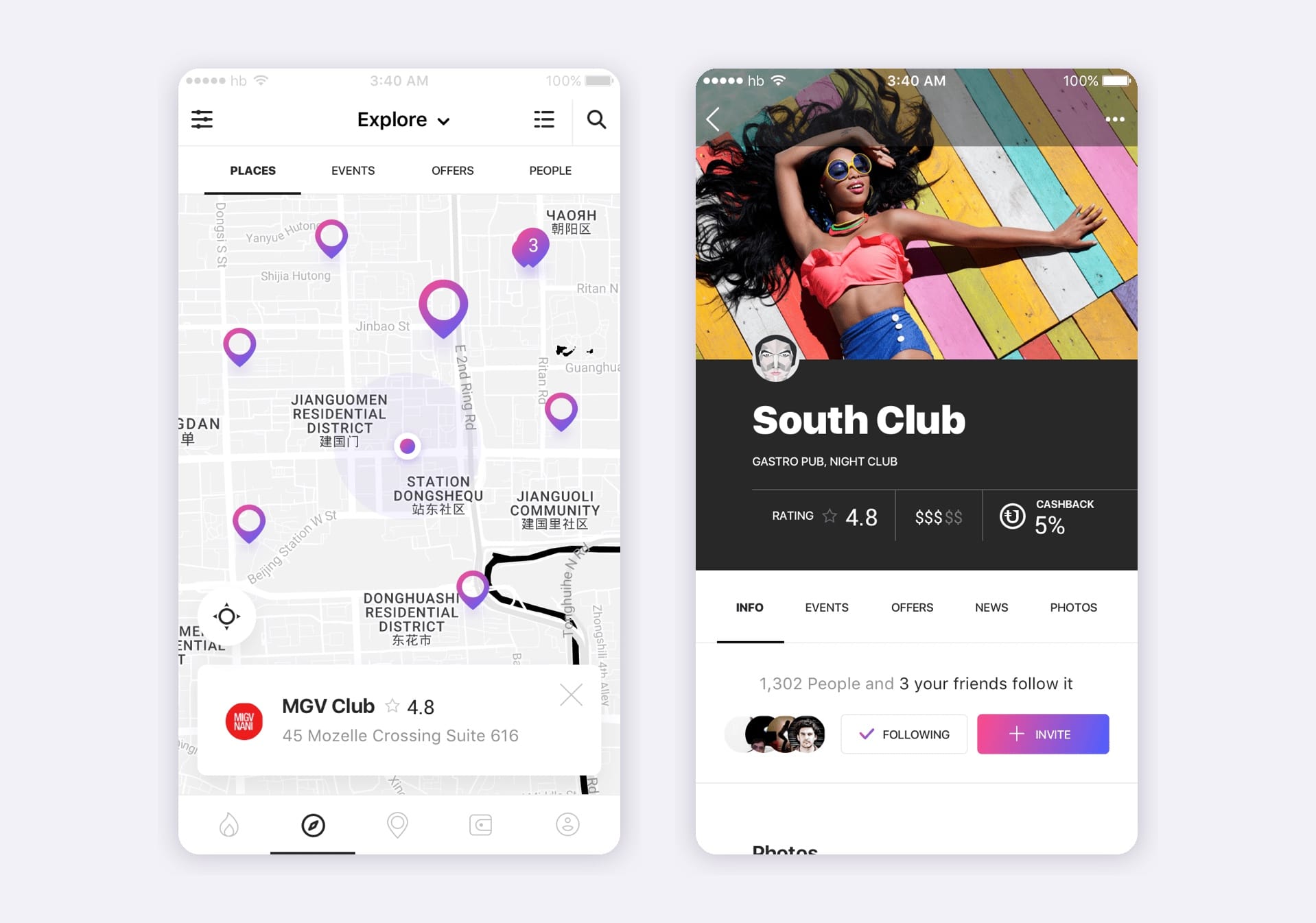
Clustering was the second lesson. Client-side clustering failed when thousands of venues sat in one area, so the final build groups nearby points in PostGIS on the server. If your map will show dense groups of points, test clustering early with representative data, before that volume reaches production.

How to create a location-based app step by step
If you're asking how to make a geolocation app on top of a product you already run, plan seven steps, with a field-tested prototype before any production code:
- Discovery and scenarios. Write down who sends coordinates, where, how often and who watches them. A courier tracked through a whole shift and a sales rep checking in twice a day need different products.
- Positioning and map provider. Match a technology from the comparison table to each scenario, then price two providers at your 12-month volume.
- Prototype and field check. Design the key screens and permission prompts, then run a rough build on real phones along real routes, including indoor stops and weak-signal areas. This is the cheapest place to catch a wrong assumption.
- First version with the core. Finished screens and fallback flows for denied or approximate location, the native location features the workflow needs, and a backend for position intake, event rules and the admin view.
- Integrations. Dispatch, CRM, payroll and payments, each checked against the launch market. On James Butler, Stripe's instant payouts weren't available in Denmark.
- Testing on the ground. Geolocation app testing covers accuracy, battery, background behavior and weak connectivity on real devices. Emulated routes check logic but miss tunnels, parking garages, OS battery savers and revoked permissions.
- Release and growth. Prepare store declarations for background location, ship, then tune intervals and geofence radii on real data.
Anton Baryshevskyi, Head of Business Development and Co-Founder at Mind Studios, explains which checks have to come before an estimate is fixed:
Founders usually ask for a firm number once the feature list looks complete. We hold off until every outside dependency has been checked against the launch market: payouts, map licenses, store review for background access. More hours can't fix those, so we confirm them in discovery and commit to the estimate after that.
Accuracy, battery and offline: the trade-offs that shape UX and cost
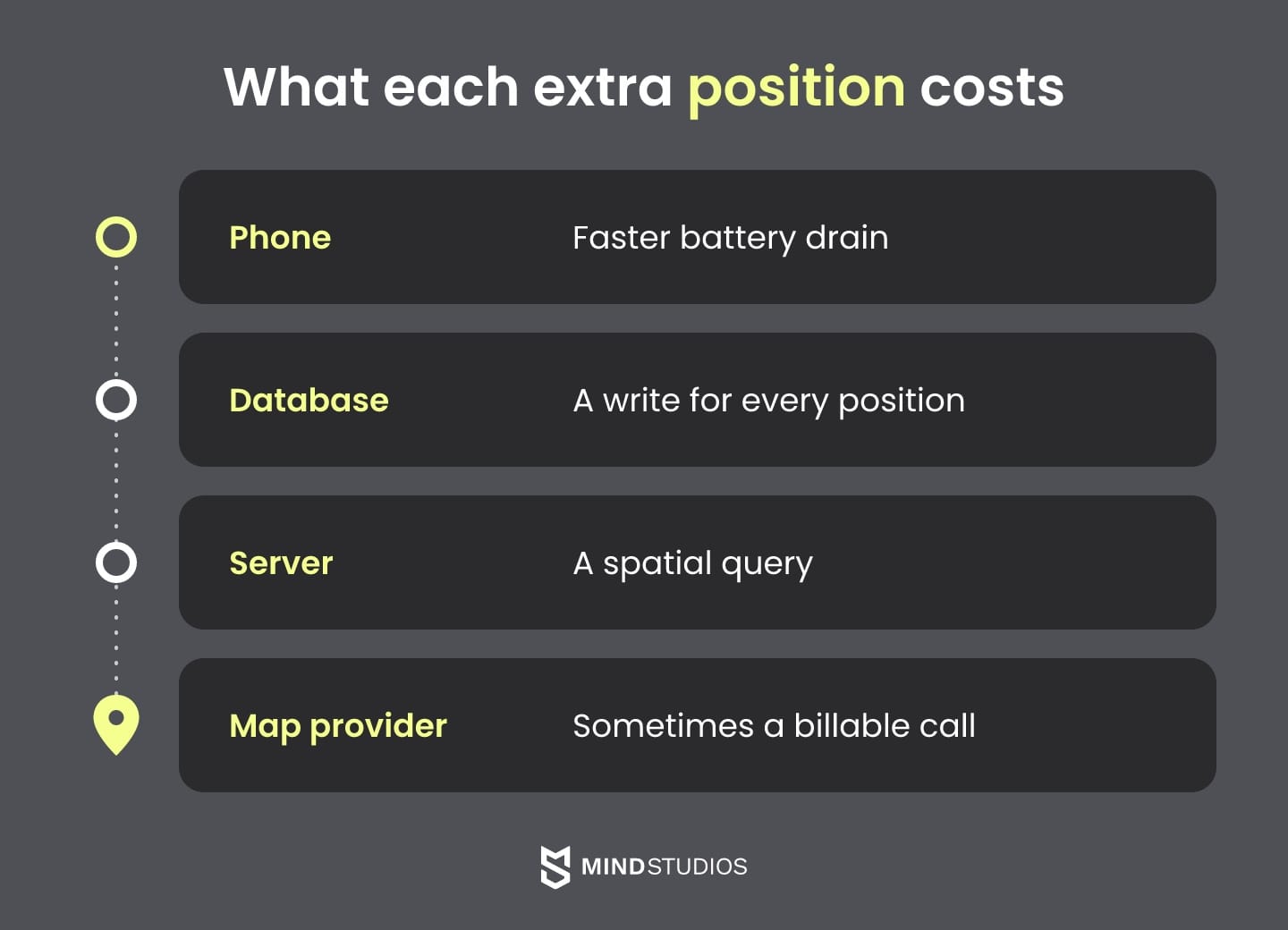
Every location product trades accuracy and update frequency against battery life and server cost. Higher accuracy and shorter intervals drain phones faster and add backend data, and provider charges rise if updates trigger billable requests such as reverse geocoding. Pick the least demanding setup that still passes the workflow's acceptance criteria.
How Android and iOS limit background tracking
For location-based services that run through a whole shift, the operating system sets the limits. Android's battery guide says background location is throttled and delivered only a few times an hour. It recommends keeping high accuracy and few-second intervals for foreground use cases.
On Android, continuous shift tracking therefore usually runs as a location foreground service, which shows a status bar notification and keeps working while the courier isn't using the app. Occasional check-ins and geofence events don't need one.
On iOS, most apps are suspended soon after they leave the screen, and their location updates are queued, per Apple's background updates guide. Timely updates need the Location updates background mode, such as a background activity session with a visible indicator, and relaunch after termination depends on the authorization level and service type.
The pairs below turn those limits into working rules:
| Do | Don't |
|---|---|
| Set accuracy and interval per role and per app state | Run high-accuracy tracking for every user all day |
| Run a location foreground service only while a shift or delivery is active | Keep the tracking notification running after work ends |
| Queue coordinates with their capture time and send them in batches when the network returns | Drop positions recorded offline or send them without a timestamp |
| Use dwell triggers and keep radii at or above the 100–150 m minimum Google's geofencing guide recommends | Draw 20-meter fences and expect instant alerts |
Acceptance criteria for location behavior
A desk demo proves little about tracking, so the criteria have to be measurable in the field and agreed before development starts:
- Coordinate age. Maximum age of a coordinate shown on the dispatcher map.
- Permission handling. Behavior when the user denies permission or grants only approximate location.
- Network recovery. Behavior when the network drops mid-route, and how queued positions sync on reconnect.
- Geofence delay. The acceptable delay: Google's guide says alerts usually arrive within two minutes, about 2–3 minutes under background limits and up to six minutes for a stationary device.
- Battery use. Drain across a full shift in an agreed scenario and device set.
How Medienlogistik verifies planned vs. actual mileage
OÖ Medienlogistik, an Austrian print media delivery company, checks each courier's mileage against the route before paying for it. At trip start, the system calculates expected mileage with the Google Maps Distance API, logs odometer readings, and a deviation engine flags detours in real time.
Approved deviations count toward payout. 100% of couriers adopted the system in the first month, and the client reports a significant reduction in payroll processing time. For any field product, decide which location evidence payroll will rely on before you choose a tracking frequency.
If you're unsure which tracking frequency and background access your scenario needs, a field prototype on your own routes will show it before the build budget is committed.
Location data privacy and app store rules
GDPR treats location data as personal data. California law treats precise geolocation as sensitive personal information, and Saudi law limits collection to what a stated purpose needs. Both app stores also make you justify every location permission. Consent, minimization and retention therefore belong in the product design from the first sprint.
What the laws require
- EU. GDPR Article 4 lists location data among the identifiers that make information personal. Article 5 limits processing to a specified purpose, the data that purpose needs and retention no longer than necessary.
- California. The CPPA FAQ lists precise geolocation as sensitive personal information. Consumers can ask a business to limit its use to purposes such as providing the requested service, with exceptions including security and fraud prevention.
- Saudi Arabia. The Saudi PDPL bars making consent a condition of a service unless the service depends on that processing (Article 7) and limits collection to the minimum its purpose needs (Article 11).
For location-based services, the Saudi rule shapes design directly: a courier app might request location only during active shifts while customers browse without granting it. Review that scenario with counsel, because a service depending on location doesn't by itself justify any level of worker tracking.
App store requirements for location access
Apple's review guidelines allow Location Services only when they are directly relevant to the app's features. Consent comes before collection (5.1.5), purpose strings have to describe the use fully, and withdrawing consent has to be easy (5.1.1).
Google Play's background location policy allows background access only for core functionality. It requires a Play Console declaration, a prominent in-app disclosure before the system prompt and a short video of the feature, and it also applies when a foreground service uses location in a way equivalent to background access.
On Android 11 and higher, users grant background location on a settings page, and approximate foreground access means approximate background access, per Android's background location guide. Your onboarding has to work for users who say no.
Privacy checklist for location features
Laws and store reviewers look at the same user flows, so one design review can cover both:
- One documented purpose per location permission, matching the iOS purpose string and the Play declaration
- Foreground-only access wherever the workflow allows it
- A disclosure screen before the system prompt that names the background feature
- An app that stays usable for people who decline background or precise location
- Separate retention periods for raw position points and trip summaries
- Role-based access to location history, with every access logged
- Consent withdrawal and deletion that reach analytics and backups
Access to stored tracks is where teams differ most. Mind Studios is ISO 27001 certified for information security management, and we expect that access model to be written down before the first route is stored.
How much does geolocation app development cost
Scope sets the cost of geolocation app development first. The three common scopes are a location feature inside a product you run, a standalone app with tracking and geofences, and a platform with a dispatcher console and live streams. Background tracking, integrations and real-time load move the estimate most. Map fees continue after launch.
The table shows what each scope usually includes and what moves its budget:
| Scope | What it usually includes | What moves cost and timeline |
|---|---|---|
| Location feature in an existing product | Map view, area search, geofence events, notifications, admin settings | How ready the backend is for spatial data, permission flows on both platforms, provider choice |
| App with tracking and geofences | Staff or customer apps, tracking, history, admin view | Background tracking on iOS and Android, offline queue, store review for background access |
| Platform with dispatch and real-time | Several apps, dispatcher console, live map, ETA, integrations | Number of live viewers, event pipeline, payroll or payment integrations, indoor positioning |
Costs that continue after launch
Three recurring costs belong in the budget from day one:
- Map, geocoding and routing fees, each billed on the provider's own unit.
- Real-time hosting for connections, the spatial database and the event queue.
- Platform updates, because iOS and Android change permission and background rules between releases, as Android 10 and 11 did for background location.
Mind Studios' insight: A dispatcher map that reverse-geocodes every incoming position pays for every ping. Geocode on status changes instead, and check the license before you reuse stored results: Google's geocoding policies let you keep place IDs indefinitely while other results follow its caching restrictions, and Mapbox bills stored results as permanent geocoding.
Engagement models
Teams buy this work under three models:
- Fixed price fits a narrow, well-specified feature.
- Time and materials fits a scope that will move after field tests.
- Dedicated team fits a platform you plan to grow for years.
Our guide to app development costs covers the general drivers.
When you don't need a custom location-based app
You probably don't need a custom location-based app in three cases: a map SDK in your current product covers the workflow, an off-the-shelf tracking service covers your fleet, or you're still testing whether customers care about location. Custom work earns its cost when a ready-made product can't support a workflow, integration or data rule you depend on.
Before you build a geolocation app from scratch, three questions narrow the choice:
- Is location a view or a process? If you only show stores or listings on a map, add a map SDK to the product you have.
- Do you only need to see where vehicles are? A ready-made tracking service handles that without a build. Compare its pricing model (per vehicle, per user or per device) with how your fleet will grow.
- Are you still validating demand? A no-code builder or a clickable prototype answers that faster than code.
Even when location events feed payroll or dispatch, a tracker with good integrations may cover the need. Custom work is justified by a payroll rule a tracker can't express, a dispatch flow it can't model or a data residency requirement its hosting can't meet, which is the work our Build & Scale team takes on.
What to bring to discovery
Discovery starts with the roles, business events and launch markets your product must support. Bring the devices your staff actually carry too, and what a late or wrong position costs you: a missed delivery window, a disputed payroll line or a false check-in.
With these inputs, the team can test which tracking intervals, permissions and providers fit the workflow. The map stays the visible part of location-based app development, while the expensive decisions get settled on your own routes.
If location is on your roadmap, a discovery phase with us turns those inputs into a scoped plan and an estimate you can budget against.
FAQ
How to create a location-based app for a business?
How to build a location-based app for a business depends on one early call: extend the product you have or launch a separate app. Extend it when location supports an existing workflow. Launch a separate app when a new user group, such as couriers or field staff, needs its own interface, permissions and release cycle.
How to make a geolocation app from an existing product?
Start with an inventory of what the product already has, in this order:
- whether your database supports spatial queries or needs PostGIS
- which roles need location and at what frequency
- whether your mobile apps can add native location modules
- which map and geocoding keys you already pay for
What does GPS tracking app development involve?
GPS tracking app development succeeds or fails on recovery, so the test plan separates three cases. After a network outage, the app queues points and syncs them with their capture times. If the system ends the app's process, tracking resumes where the platform allows it or the dispatcher map flags the gap. If the user closes the app, tracking ends and dispatch sees that too.
Can we build our own map app, or should we use Google Maps or Mapbox?
Use a provider's SDK for the base map unless one of three conditions holds: its license blocks your use, field staff need offline maps it can't supply, or data residency rules out commercial services. Even then, building on the OpenStreetMap stack is faster than drawing maps from scratch.
What drives the cost of location-based mobile app development?
An estimate for location based mobile app development firms up once the team has four inputs:
- each role that sends positions, with its interval and background needs
- the integrations location events feed, such as dispatch, payroll or payments
- the number of people watching live maps at peak
- whether any workflow needs indoor accuracy
Without these answers, a quote for location based app development prices assumptions instead of your workflow, and the gap in a geolocation app development budget surfaces during field tests.
How accurate is a location-based app indoors versus outdoors?
Outdoors, satellite positioning works best under open sky and degrades near tall buildings. Indoors, Wi-Fi location lands within tens of meters: enough to confirm arrival at an isolated depot, too coarse for one office among neighbors. Aisle or room level needs Wi-Fi RTT access points, BLE beacons or UWB devices, calibrated on site.
How do location-based apps affect battery life?
The impact depends on your interval and devices, so it's measured rather than estimated. A field test runs a full shift on the cheapest phone your staff use, with the real interval, accuracy and screen-off time, and compares drain with tracking on and off. Both operating systems throttle background apps, so a phone left on a desk gives misleading results.
What are examples of apps that use location-based services?
Location-based services in business apps follow two patterns. Some use the device's current position: delivery ETAs, technician check-ins, fleet stop events and pickup arrival alerts. Others search an area the user chooses, such as a property map or a store finder. These can work without asking for location permission, which keeps onboarding shorter.
What do GDPR and CCPA require for location data?
Under GDPR, location data is personal data: each use needs a lawful basis under Article 6 and has to respect the purpose, minimization and retention limits of Article 5. Under California law, precise geolocation is sensitive personal information, and consumers can ask a business to limit its use to permitted purposes.